The BJNorth team advise the passing and sad loss of Barrie Jones on 7th December.
Barrie, a Director, partner, mentor and colleague at BJNorth will be sadly missed, along with his wisdom and tales of woes and tribulations.
BJNorth offers comprehensive 3D laser scanning services for the safe and rapid collection of 3D data, with immense detail and accuracy. The data collected can then be used to construct digital three-dimensional models.
Quick capture (1 million points per 15 minutes cycle)
Safe working environment ( don’t need to physically access the points to be captured)
Everything is captured. If the scope of works change or additional information is required it can be extracted from the point. cloud without having to revisit the site
Long term advantage is data can be used for future projects
Provide an archive or “as-construct” for a point in time
Provides instant 3D digital model of subject and provides end user with powerful visual tool
Capture can be undertaken at night or during daylight.
BJNorth are the first in Australia to have the GeoSLAM ZEB Discovery Mobile Laser Scanner
Versatile and worn as a backpack
300,000 points per second
Accuracy 20 to 25mm
BJNorth Surveyors are the 1st surveying company in Australia to have this new GeoSLAM ZEB Discovery
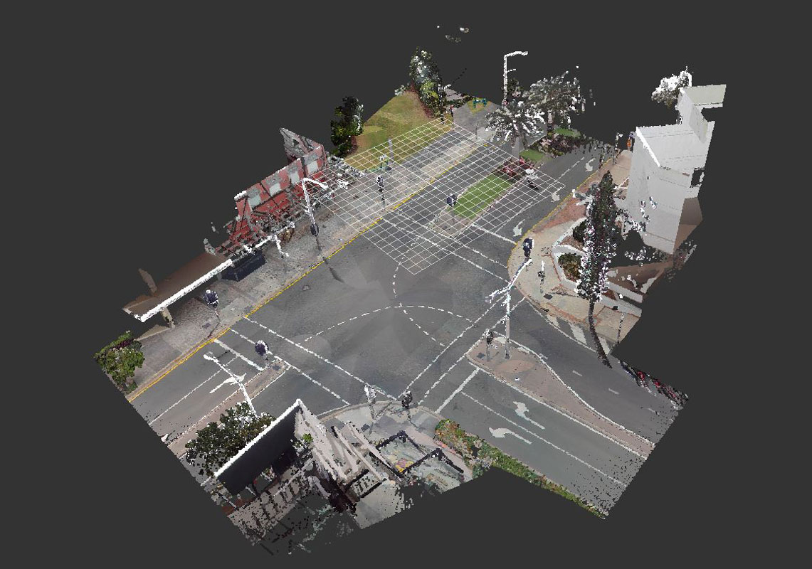
Scanned Road Intersection
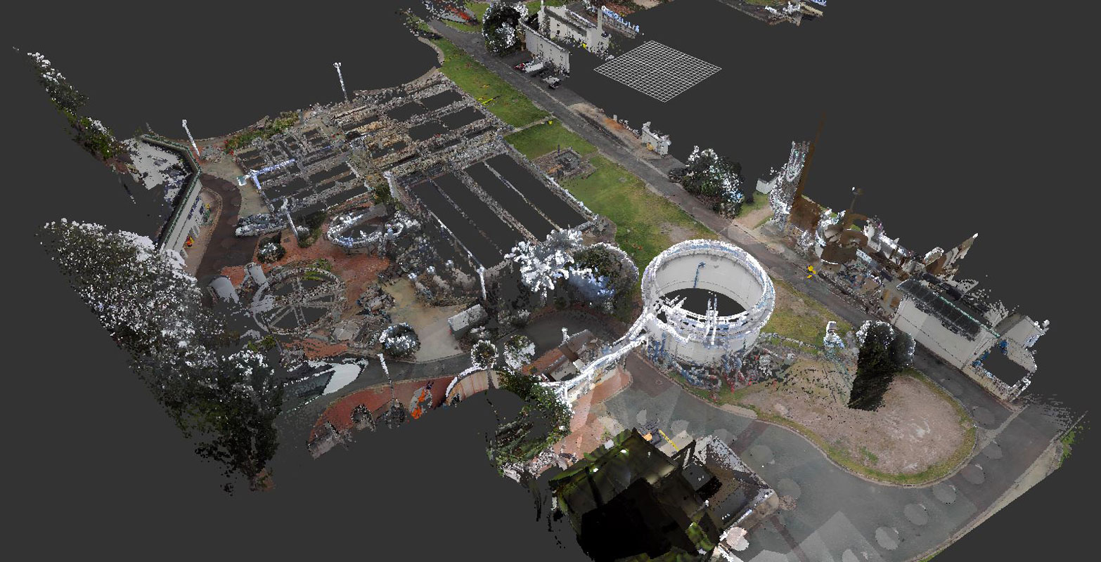
Scanned Sewage Treatment Plant
Mobile Laser Scanning - Case Study
Unlike vehicle mounted mobile scanners, BJNorth’ s ZEB Discovery is worn as a backpack by the operator. It is operated at normal walking pace allowing easy access to footpaths, walkways, alleys and other areas that would not normally be accessible to vehicle mounted scanner units.
The units versatility makes it suitable for scanning indoors or outdoors in open spaces. If desired it can be operated from a moving vehicle.