
Case Study
B3507 – Aurizon CQCN (Culvert) Structures Renewals FY21
Background
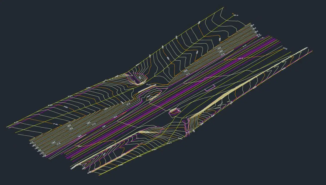
GHD were commissioned to perform detailed design for the culvert renewal works for 44 culvert locations to enable Aurizon to engage the market for construction. GHD engaged BJNorth Surveys to provide detail surveys of the 44 culvert locations as per Aurizon survey specifications. This included the requirement of underground services for rail and third party services.
The Aurizon survey standards are mirrored with the Queensland Rail survey standards and are specifically tailored for rail features and not necessarily suitable for Engineering design of culverts. For example, the survey standard is for surface to be to the bottom of ballast, where for hydrological modelling and culvert design the ballast and rail should be included in the surface.
Solution
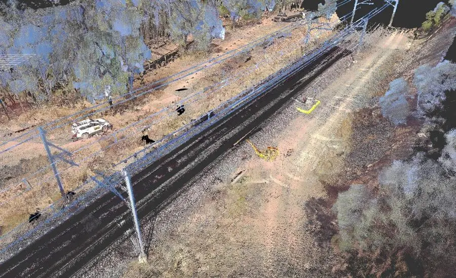
As the scope of works set out the survey requirement to follow Aurizon survey standards, these were followed. However, BJNorth Surveys conducted an additional Backpack/Handheld Laser Scanning solution (WLS – Walking Laser Scanning).
The concept was that the additional WLS scan data would provide additional ancillary information
that was not captured as part of the required survey standards. For example, under the survey
standards, masts are surveyed using the TCB (Top Centre Bolt) of the mast and not the physical
structure itself.
In addition, the WLS scan data would potentially capture areas that were unsafe to physically
access, eg the top of bridges and culverts that are inaccessible or deemed unsafe by the Rail
Safety Protection Officers.
The scan data is limited by line of sight so vegetation around the structures impedes the capture
of the culverts and the accuracy is less than direct measurement with total Station.
Outcome
After the survey was performed and delivered, it became more apparent that additional information was necessary for the design of the culverts, including items such as the mast concrete footing dimensions. This is important for the location of the footings in relation to the proposed design (subsurface).
The colourised point cloud provided the design engineers with additional data (O/H wires,
vegetation, access) that may potentially influence design and/or construction methodology.