
Case Study
Recycled Water Network - Stage 2
Background
The City of Gold Coast (CoGC) required detail survey for the upgrade and expansion of the recycled water network to supply non-residential customers for irrigation and other uses. The scope of work included the design of new pipelines to service the catchments of Broadbeach and Carrara. The brief required the 3D laser scanning of major road crossings, detail survey of proposed pipeline corridors and the detection and survey of underground services.
Solution
Initially, several road crossings were scanned using a Trimble SX10 laser scanner. While this instrument was fit for purpose for small intersections, an option for long corridor 3D laser scanning was required.
A few mobile laser scanning options were identified as possible solutions, including Mobile Laser Scanning (MLS), Unmanned Aerial Vehicle (UAV / Drone) and a Backpack/Handheld Laser Scanning solution (WLS – Walking Laser Scanning). Due to most of the proposed pipeline corridors being within the footpaths, it was decided to trial the WLS Solution.
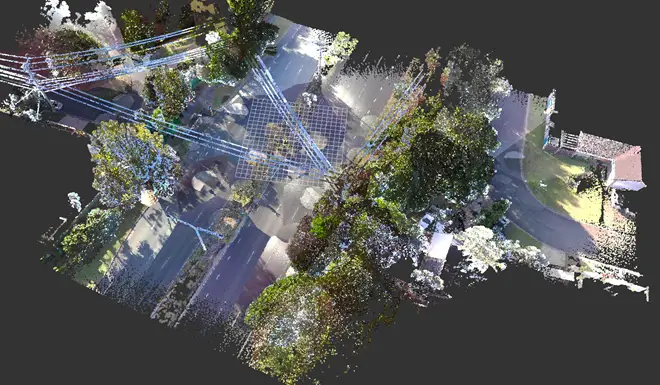
Several WLS solutions were trialed with the ZEB Discovery being the most capable in terms of capturing the corridors. There was a bit of testing and trialing to determine the most appropriate field and office techniques and processes in order obtain an optimal solution.
Outcome
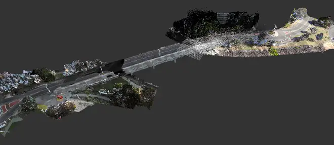
The end result of using the WLS solution exceeded expectations. One of the main advantages of this system is the speed of the capture. After laying down ground control targets and determining the scan route, the capture is as simple as walking the route. The field capture was completed quickly, efficiently, and safely.
The data processing allows the ability to choose the images used for the colourising of the scan. In this case we were able to select images with the least number of obstacles (usually vehicles on the road) to make the road grey instead of the colour of the vehicles on the road.
The resulting colourised point cloud is seamless and very visually aesthetic. The registrations of the point cloud to the ground control targets are typically in the 20-30mm range on hard surfaces. QA comparisons of the scan data to Total Station survey data are consistently better than 20-30mm.
The additional detail obtained allows more decisions able to be made during design such as full visualization of all features, the proposed construction methodology (traffic constraints, vegetation canopies for height restrictions etc.)